On the first day of meteorological summer, 1News weather expert Daniel Corbett explains why El Niño is yet to bring some places the expected warm and dry weather.
Summer is upon us and you might be ready to break out the BBQs and beach towels. But, as you’ve probably heard, El Niño will likely have a say in that.
On the upside, some of us could be in store for a warmer and drier than normal summer.
It seems like we’ve been talking about El Niño for months and the warm and dry weather it might bring. So why have we had more persistent rain for eastern parts of the country - more than was expected in some places?
Take for example Gisborne which has received 222mm so far in November. A typical November would only bring 72mm so that’s more than three times the average monthly rainfall.
Napier has had above double the normal monthly rainfall so far at 109mm, compared to typically only 49mm. Tauranga has received 135mm, well above the norm of 72mm.
'Other factors' get in the way
Wasn’t El Niño meant to bring drier than normal rainfall to these locations?
According to the seasonal forecast, yes. But the atmosphere has had other ideas so far.
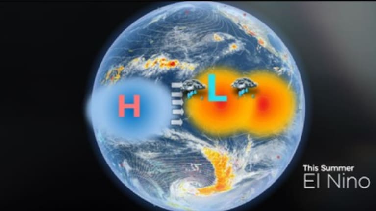
El Niño has developed across the Pacific Ocean and all the typical signals are showing up strongly, such as the warmer than normal seas, weaker trade winds and high pressure over Indonesia, as the image below shows.
The big difference so far has been the “other factors” that have influenced the weather across New Zealand - more so than El Niño.
These include the colder surges from the Southern Ocean as well as the strength and motion of the jet stream (which carries the weather systems and rainmakers).
Instead of just passing by, they have lingered and brought significant rainfall in places.
It is a bit like El Niño turned up for the spring recital expecting the starring role but so far has only managed a bit part at the back of the stage. The “other factors” have been the stars of the play.
This summer and last summer compared:

El Niño v El Niña

Will this change and better weather take over?
El Niño will get the chance to take centre stage but it will have to wait until the other factors have weakened or moved on.
At this point the next several weeks could see more a more notable appearance from El Niño, but the other factors could linger into the Christmas run-up.
Remember, the typical El Niño pattern shifts our summertime highs a bit further north across the top of New Zealand. This means fine and drier weather for the north and east, but cloudier and wetter weather for the far southwest of the country.
What does all that mean for our summer weather?
We still stand a chance of seeing some active fronts for the first few weeks of summer but – here’s the good news - the areas of fine weather will become more prevalent. These fronts will continue to lose their punch and moisture as we get closer to Christmas.
There will also be some good warm, and even hot, spells as some more of that Aussie heat drifts our way.
So, what about Christmas?
Does that mean Christmas will be a scorcher or a wash out? It’s too early to say exactly but the trend is for more settled weather, especially the further north and east you are.
Don’t forget Christmas can always be a tricky one to forecast as it only takes one small area of cloud or rain to spoil that morning beach cricket game.
There's the possibility of the odd wild card too - a tropical cyclone from the north or an active rainmaker that lingers in the more volatile jet stream of current times.
Whatever weather comes your way, enjoy the summer!


SHARE ME